grannycart.net
On maps
Various current professional work (maps in R and Python)
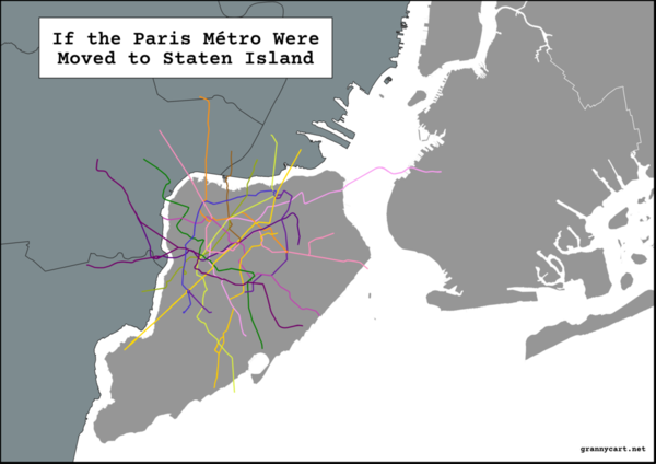
Paris vs Staten Island
- See git repo for files
NYC rezoning map
- Created for a unique rezoning initiated in the Two-Bridges neighborhood. This rezoning was initiated by local community organizations with limited resources. I volunteered to create and update maps required by the Department of City Planning. Virtually every detail of this map was set to meet DCP's requirements specifications for rezoning maps.
Research maps of Chicago
- An analysis of MFI by community area in Chicago. These were maps for research purposes, not publication.
Sub-borough maps of NYC
- A sub-borough area/PUMA map of NYC included in CUP's Affordable Housing Toolkit. I laid out the map layers in QGIS, and worked with designer Manuel Miranda to create a polished final version.
- I also worked with a developer to update the data in CUP's interactive map that shows incomes in NYC relative to housing subsidy targets in each sub-borough area.
- http://envisioningdevelopment.net/map/ (Note: this is an old site created in Flash. You will need to enable Flash in your web browser to use it.)
What Is FAR?
- I led a team of designers and developers to create a interactive tool that uses hand-drawn graphics to walk you through the basics of how Floor Area Ratio (FAR) works. FAR is a key concept underlying much of NYC's zoning.
NYC Garbage infrastructure scaled to the size of Fresh Kills Park
- At the request of an artist, I used GIS to calculate points if all of NYC's garbage infrastructure sites were scaled down to fit in the space of Fresh Kills Park in Staten Island.
- NYC Scaled Garbage Points (Github repository)
R script to calculate median incomes
- I put together a simple R script to calculate median incomes from abitrary Census geographies.
- Estimate Medians (Github repository)
Gulf Coast Mississippi GIS Analysis
- Maps I created of Biloxi for an internship and for my graduate thesis.
Maps for a landscape architecture studio
- A little designy-ier, a little more unconventional, a little more polished. All are visions for a development site in Philadelphia.
- Site overview
- Site context maps
- Site concepts for development (renderings in Sketchup, Illustrator, and other vector-based software)
